
The Invisible Giant of the East and the Red Pandas
The “Greater Nepal” of the past once included today’s Sikkim and Darjeeling, legendary lands at the eastern foot of the Himalayas. For centuries, they served as trading gateways to Tibet and as junction between the vast plains of the Ganges and the immense Tibetan plateau. Towering above the region stands Mt Kanchenjunga (8,586 m), straddling the border between Nepal and India. Long considered the highest mountain in the world before Dhaulagiri and later Mt Everest took that title after British surveys in 1849, Kanchenjunga is a reminder that no glory lasts forever !

We are now heading toward Darjeeling, Sikkim (now part of India), and the northern part of Nepal’s Koshi Province, skirting the southern side of this huge massif in the hope of reaching its foothills.
This remote region has a complex history. It was once part of the Kingdom of Nepal, founded in 1768 after Gurkha king Prithivi Narayan Shah conquered the Kathmandu Valley. Inevitable frictions with the fast expanding East India Company eventually led to the Anglo-Nepalese War of 1814–1816. The conflict ended with the Treaty of Sugauli, forcing Nepal to give up roughly one third of its territory, including the plains of the Terai and the areas that are now Darjeeling and Sikkim. During these campaigns, the British encountered the fearless Gurkha soldiers for the first time, whom they later recruited into their own army — a tradition that still continues today.
The region’s history is as intricate as its geography. Sikkim remained an independent kingdom until 1975, when India annexed it to strengthen its northern border with China and maintain territorial continuity around newly independent Bangladesh (created in1971).
For lovers of geopolitics and geography alike, this area is endlessly fascinating.
We first cross the great plains of southeastern Nepal (Thé ou café ? L'âme de l'Ilam), where pre-monsoon mist drifts over tea plantations, forests of sal trees, and fragments of jungle still roamed by wild elephants. Despite the inevitable urbanization, echoes of Kipling’s India remain.

Crossing the border over one of the many tributaries of the Ganges requires patience while Indian officials stamp our papers again and again with utmost attention to details, in characteristic indian administration tradition...

Eventually we make it through and enter the famous “Chicken’s Neck,” the narrow 17-kilometer-wide corridor separating Nepal from Bangladesh before reaching Siliguri, the city linked to the old treaty.
It feels like many other Indian cities we have passed through: endless traffic jams, construction sites tearing open the streets, half-finished buildings, cows feeding on garbage, and residents navigating the chaos with calm resignation.
From there we continue north into Darjeeling, whose tea became famous worldwide after the British introduced plantations around 1850 to compete with Chinese tea (and offset East Indias Company abyssal trade deficit). Carefully maintained tea gardens spread across the hills between the tributaries of the Brahmaputra River.
Here, close to the Ganges basin, the watersheds of two of Asia’s greatest rivers meet before eventually joining in the immense delta that nourishes — and often floods — much of Bangladesh.

Slowly we climb away from the plains toward Sikkim, crossing colonial-era railway lines along the way.

We pass below Kalimpong, another legendary place in the history of Himalayan exploration. Alexandra David-Néel once lived here before traveling across Tibet to Lhasa in the 1920s. Later, the Dalai Lama’s brother, who acted as an envoy to China, also lived here after fleeing Tibet following the Chinese annexation in 1959.
We are now in lands where India, Tibet, and China have interacted for centuries through migration, trade, and religion.
As we climb the narrow valleys leading toward Kanchenjunga, Indian culture gradually gives way to Nepalese and Tibetan influences. Buddhist stupas appear everywhere, and most people speak Nepali or Tibetan dialects. Bhutan is close by, and the atmosphere recalls the mountain peoples we once encountered in the land of the dzongs.
Nepalese culture remains especially visible through the Newars, originally from the Kathmandu Valley. For centuries they traded along the routes into Tibet, establishing merchant outposts throughout the region. Salt, spices, yak wool, and precious stones once crossed these formidable mountain passes in caravans. Many Newars settled permanently here, partly because of discrimination they faced in 19th-century Nepal. Their trade with Tibet ended after China annexed Tibet in 1959, but their presence remains strong today, linking families between Kathmandu, Gangtok, and Darjeeling.
They live quietly alongside Tibetans and other mountain communities.


The mountains are immensly tall and the roads painfully slow. Reaching Gangtok, the capital of Sikkim, takes time. Built along steep mountainsides, the city stretches for kilometers around a single climbing road leading to its monastery. Last year the city celebrated the fiftieth anniversary of Sikkim’s annexation by India with great enthusiasm !
Posters of Prime Minister Modi still decorate the streets, praising the successful integration of the former kingdom into “Greater India.” Meanwhile, the son of the last king is said to have spent the last decades in retreat, meditating on the impermanence of all things — including his own kingdom...


But where is Kanchenjunga itself?
Hidden in the clouds.
The monsoon has arrived weeks too early, and huge masses of clouds hide the mountain almost constantly. One morning we briefly glimpse a snowy peak between two clouds, but even from the monastery overlooking Gangtok, the mountain refuses to reveal itself in its full glory.
We therefore decide to take refuge in meditation, joining the local monks in their mantra chanting.

Sikkim is world-famous for its orchids, which cover the jungle trees across the mountains. Gangtok even has a beautiful orchid museum, where, naturally, one newly discovered species has been named in honor of Prime Minister Modi.
Since the eastern side of Kanchenjunga remains hidden, we head south again, circling around eastern Nepal before climbing toward Ilam on the western foothills of the massif.
It is a pleasure to rediscover Nepal’s rolling tea hills once again. Less famous than neighboring Darjeeling but part of the same landscape, Ilam’s plantations stretch across the hillsides only a few kilometers from the Indian border.

Yet once again the early monsoon spoils our hopes. Thick fog covers the pass from which we should have seen Kanchenjunga.
The road — surprisingly well paved for Nepal — crosses one mountain ridge after another. Hairpin turns pile up endlessly. It takes us nine hours to cover barely 150 kilometers before finally reaching Taplejung, the last district before the Kanchenjunga Conservation Area.
There we meet young people developping a local project aiming at promoting eco-friendly tourism that would also benefit local communities.
The next morning we visit the “Red Panda House,” a beautifully designed lodge funded by Scandinavian donors and built by a Swiss architect. It offers a glimpse of what future eco-tourism accommodation around Kanchenjunga could become, far more comfortable than the very basic tea houses found in regions like Annapurna.

Unfortunately, the road leading there has reportedly been under construction for ten years, for only two kilometers.
Nepal’s political dysfunction, corruption, and endless delays seem almost as deep as the muddy ruts where even our 4x4 nearly gots stuck several times.
This is Nepal at its most frustrating, wasting extraordinary potential through sheer mismanagement.
But Nepal also has another so richer side: the extraordinary warmth of its people. That evening, Sherpa women dressed in traditional clothing welcome us alongside local young people gathered at the Red Panda House.
But where are these famous red pandas, supposedly the future stars of the region, like rhinos in Chitwan?


The locals admit they have barely seen one themselves (the above picture is an internet download). Still, they assure us the animals do live here, from central Nepal all the way to Yunnan in China. If the region hopes to build tourism around them, the shy creatures may eventually need to appear more often.


More backbreaking road hairpins follow. We descend a thousand meters, climb another thousand, and again...and finally enter the valley leading to Lelep, the small village that serves as the starting point for treks toward Kanchenjunga.
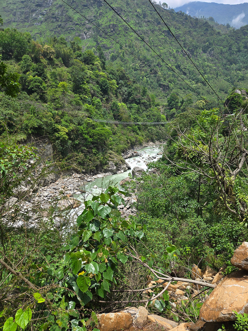
The weather is now fully monsoon-like: heavy rain every night, clear mornings, and clouds building by early afternoon. Forecasts predict the same for the next two weeks. I discuss the situation with my Sherpa guide, who knows the region well. Should we attempt the twelve-day trek to Kanchenjunga Base Camp?
“Up to you…” he replies unconvincingly.
In the end, given the conditions and his hesitation, I decide to give up the trek. The mountains are soaked with water, the high passes are snow-covered, and there are no easy escape routes in this region. Disappointing it is, but if Kanchenjunga does not wish to reveal itself now, another opportunity will surely come someday. Better safe than sorry.
We continue farther north toward Tibet, passing one hydroelectric dam construction site after another. The track — it can hardly still be called a road — is torn apart by muddy ruts and heavy trucks carrying construction materials. Trucks heading back down are loaded with mysterious covered cargo. We suspect illegal logging, as cut tree trunks line the roadside.

In these isolated valleys where only a few thousand people remain scattered among tiny villages, the presence of the state is weak. Institutions are distant and ineffective, while the enormous sums involved in hydroelectric projects create endless opportunities for corruption.
When we finally reach Lelep, the last real village in the valley, we sleep in tents because accommodation is almost nonexistent.


Limbu, Sherpa, and Gurung communities coexist here in these dramatic valleys disappearing into the hidden slopes of Kanchenjunga. Life depends on modest subsistence farming while many hope that sustainable tourism might one day provide new opportunities, if political leaders can align their interests with those of local people.
One family running a very basic tea house proudly shows us a portrait of their son serving in the British Gurkha Brigade. For nearly two centuries, this has been one of the most prestigious ways for young men here to leave the mountains.

Young people are rare in these villages, and many dream of lives far away from home. One Tibetan young man explains that he comes from the last settlement before the border, where his parents still raise yaks as nomads after fleeing Tibet in 1959. He himself left to study in Darjeeling.
Nearby, a group of teenage girls has formed a K-pop dance group inspired by Korean stars they follow on Instagram, eventhough they have never left their remote Himalayan valley.
Convincing this generation to invest in local development may prove as difficult as climbing the steep slopes surrounding these valleys.

The light is magnificent in the early morning before the monsoon clouds gather once again for the daily rain, as we start the two-day drive back down to the Terai plains and eventually Kathmandu.
Mysterious Kanchenjunga never revealed itself to us, nor did the red panda. Both remain hidden secrets of these distant Himalayan lands.


Comments